Category:138 Project Development Chronology: Difference between revisions
m Major Milestones for Projects info added |
No edit summary |
||
| (47 intermediate revisions by 3 users not shown) | |||
| Line 1: | Line 1: | ||
[[image:138 | [[image:138 2013.jpg|left|460px]] | ||
| Line 8: | Line 8: | ||
MoDOT considers an area’s safety concerns, growth, traffic patterns and transportation needs. When a need is identified, MoDOT meets with local government, community leaders and transportation users to discuss the project. | MoDOT considers an area’s safety concerns, growth, traffic patterns and transportation needs. When a need is identified, MoDOT meets with local government, community leaders and transportation users to discuss the project. | ||
[[104. | [[104.2 Project Scoping |'''138.2 Planning''']] | ||
[[image:138.2.jpg|right|210px|thumb|<center>'''MoDOT customer service center representatives are available to assist with the public's comments, suggestions and questions. Representatives can also place the public in touch with study team members for detailed study matters.'''</center>]] | [[image:138.2.jpg|right|210px|thumb|<center>'''MoDOT customer service center representatives are available to assist with the public's comments, suggestions and questions. Representatives can also place the public in touch with study team members for detailed study matters.'''</center>]] | ||
MoDOT proposes and evaluates several possible improvement locations and assesses possible [[907.9_Safety_Assessment_For_Every_Roadway_(SAFER)|safety improvements]]. The Missouri Highway and Transportation Commission reviews public comments and other information concerning the proposed improvement before further development of the improvement. | |||
[[104. | [[104.8 Public Involvement in Project Scoping |'''138.3 Public Consulted''']] | ||
MoDOT | At this stage, MoDOT announces to the public what improvement is proposed to address the need. Response from the interested groups and individuals is collected and considered as development of the improvement continues. | ||
[[104.9 Environmental Considerations |'''138.4 Impact Assessment''']] | [[104.9 Environmental Considerations |'''138.4 Impact Assessment''']] | ||
| Line 40: | Line 40: | ||
|'''[[:Category:126 Location Study and Alternatives Analysis |Location Study]]''' - Date location approval is granted by the Missouri Highway and Transportation Commission. | |'''[[:Category:126 Location Study and Alternatives Analysis |Location Study]]''' - Date location approval is granted by the Missouri Highway and Transportation Commission. | ||
|- | |- | ||
|'''[[:Category:130 Value Engineering|Value Engineering Study]]''' – VE study date to be entered for projects that have been selected for a VE study as per the District VE Work Plan. Consult with a District Value Engineering Coordinator and/or the Innovations Engineer for project selection, team composition and timing for VE study. | |'''[[:Category:130 Value Engineering|Value Engineering Study]]''' – VE study date to be entered for projects that have been selected for a VE study as per the District VE Work Plan. Consult with a District Value Engineering Coordinator and/or the Policy and Innovations Engineer for project selection, team composition and timing for VE study. | ||
|- | |- | ||
|'''[[127.14 National Environmental Policy Act (NEPA) Classification and Documents|NEPA Approval Date]]''' -The date the project is given a NEPA approval from FHWA. (This approval will be a CE, FONSI or ROD). Resubmit a Request for Environmental Services if scope change occurs, e.g. additional ROW, length, or project description. Project changes warrant review of NEPA approval. | |'''[[127.14 National Environmental Policy Act (NEPA) Classification and Documents|NEPA Approval Date]]''' -The date the project is given a NEPA approval from FHWA. (This approval will be a CE, FONSI or ROD). Resubmit a Request for Environmental Services if scope change occurs, e.g. additional ROW, length, or project description. Project changes warrant review of NEPA approval. | ||
| Line 46: | Line 46: | ||
|'''[[:Category:235 Preliminary Plans|Preliminary Plans Approved]]''' - Date preliminary plans are completed. All changes resulting from the Design Hearing and VE Study have been incorporated. | |'''[[:Category:235 Preliminary Plans|Preliminary Plans Approved]]''' - Date preliminary plans are completed. All changes resulting from the Design Hearing and VE Study have been incorporated. | ||
|- | |- | ||
|'''[[ | |'''[[:Category:747 Bridge Reports and Layouts|Bridge Survey Submitted]]''' - Date the Bridge Survey Report is submitted to Central Office Bridge. | ||
|- | |- | ||
|'''[[236.13 Designing Right of Way Plans|R/W Plans Approved]]''' - Date the district certifies r/w plans. | |'''[[236.13 Designing Right of Way Plans|R/W Plans Approved]]''' - Date the district certifies r/w plans. | ||
| Line 56: | Line 56: | ||
|'''[[127.2 Historic Preservation and Cultural Resources|Cultural Resources Clear]]''' - Date the State Historic Preservation Office (SHPO) has concurred that cultural resources actions taken by MoDOT are sufficient to allow the project construction to proceed. | |'''[[127.2 Historic Preservation and Cultural Resources|Cultural Resources Clear]]''' - Date the State Historic Preservation Office (SHPO) has concurred that cultural resources actions taken by MoDOT are sufficient to allow the project construction to proceed. | ||
|- | |- | ||
|'''[ | |'''[https://epg.modot.org/index.php?title=127.4_Wetlands_and_Streams#127.4.1.2_Laws_and_Regulations 404 Permit Received]''' - Date of permit receipt from the US Army Corps of Engineers. | ||
|- | |- | ||
|'''All Environmental Issues Finalized''' - The date planning and negotiations have been completed for environmental aspects of the project. All permits, MOAs, mitigation plans, all agency reviews, etc. are completed or approved prior to construction for the following: Farmland Impact, Floodplain/Regulatory Floodway, FEMA/SEMA Buyout, Socioeconomic Impact, Threatened & Endangered Species, Public Land Impact, Hazardous Waste Impact, Air & Noise Impact and the Wetland Impact. Refer to [[:Category:127 MoDOT and the Environment|EPG 127 MoDOT and the Environment]]. | |'''All Environmental Issues Finalized''' - The date planning and negotiations have been completed for environmental aspects of the project. All permits, MOAs, mitigation plans, all agency reviews, etc. are completed or approved prior to construction for the following: Farmland Impact, Floodplain/Regulatory Floodway, FEMA/SEMA Buyout, Socioeconomic Impact, Threatened & Endangered Species, Public Land Impact, Hazardous Waste Impact, Air & Noise Impact and the Wetland Impact. Refer to [[:Category:127 MoDOT and the Environment|EPG 127 MoDOT and the Environment]]. | ||
| Line 64: | Line 64: | ||
|'''Utilities Clear''' - Date the district certifies utilities are clear. This is defined as the date utility agreements have not only been executed but the adjustments are complete or at a point that no delay is expected to the road contractor. All utility adjustments have been coordinated with the road construction and all provisions have been included in the plans. Refer to [[:Category:643 Utility Procedures|EPG 643 Utility Procedures]]. | |'''Utilities Clear''' - Date the district certifies utilities are clear. This is defined as the date utility agreements have not only been executed but the adjustments are complete or at a point that no delay is expected to the road contractor. All utility adjustments have been coordinated with the road construction and all provisions have been included in the plans. Refer to [[:Category:643 Utility Procedures|EPG 643 Utility Procedures]]. | ||
|- | |- | ||
|'''[[237.9 Submission of Plans and Supporting Documents# | |'''[[237.9 Submission of Plans and Supporting Documents#237.9.3 PS&E Submittal Guidelines|PS&E Submittal]]''' - Date the Bridge Plans, Specifications, & Estimates (PS&E) are submitted to Central Office Design. | ||
|- | |- | ||
|'''[[237.9 Submission of Plans and Supporting Documents#236.9.6 Electronic Plans PS&E Submittal Guidelines|Roadway PS&E Submitted]]''' - Date the Roadway Plans, Specifications, and Estimates (PS&E) are submitted to Central Office Design. | |'''[[237.9 Submission of Plans and Supporting Documents#236.9.6 Electronic Plans PS&E Submittal Guidelines|Roadway PS&E Submitted]]''' - Date the Roadway Plans, Specifications, and Estimates (PS&E) are submitted to Central Office Design. | ||
| Line 75: | Line 75: | ||
[[:category:238 Surveying Activities |'''138.6.3 Surveys.''']] A survey physically establishes the location in the field in accord with the approved location. The survey includes the location of all man-made features in relation to the established centerline and also includes elevations on National Geodetic Survey (NGS) or United States Geodetic Survey (USGS) datum necessary to locate grades, culverts, bridges, and to compute excavation quantities. | [[:category:238 Surveying Activities |'''138.6.3 Surveys.''']] A survey physically establishes the location in the field in accord with the approved location. The survey includes the location of all man-made features in relation to the established centerline and also includes elevations on National Geodetic Survey (NGS) or United States Geodetic Survey (USGS) datum necessary to locate grades, culverts, bridges, and to compute excavation quantities. | ||
[[ | [[236.13 Designing Right of Way Plans|'''138.6.4 Right of Way Plans.''']] Detail plans are prepared to provide the information and details necessary to construct transportation improvements to criteria required to address the need of the improvement. The plans show all existing topographic features and the disposition of existing improvements affected by the proposed construction and indicates the right of way necessary to allow room for the improvement’s construction and maintenance, and in sufficient detail to write deeds and acquire the right of way to the dimensions shown on the plans. | ||
'''138.6.5 Basic Design Criteria''' | '''138.6.5 Basic Design Criteria''' | ||
| Line 95: | Line 95: | ||
'''138.9 Road Maintenance''' | '''138.9 Road Maintenance''' | ||
MoDOT maintains the facility to meet the needs of travelers. Should the road eventually be found to not meet travelers’ needs, a new “need” will be identified and the process to improve the facility begins again. | MoDOT maintains the facility to meet the needs of travelers. Should the road eventually be found to not meet travelers’ needs, a new “need” will be identified and the process to improve the facility begins again. | ||
<div id="Our maps are a record of the many groundbreakings"></div> | |||
[[image:138.8.jpg|center|820px]] | [[image:138.8.jpg|center|820px]] | ||
| Line 101: | Line 102: | ||
!align="center" style="background:tan" colspan="3"|Our maps are a record of the many groundbreakings over the decades | !align="center" style="background:tan" colspan="3"|Our maps are a record of the many groundbreakings over the decades | ||
|- | |- | ||
|rowspan=" | |rowspan="8"|[[image:138 1939 map.jpg|225px]]||style="background:#fff8e7" align="center" colspan="2" width="450"|[[media:1918 map.pdf|1918 road map]] | ||
|- | |- | ||
|style="background:#fff8e7" align="center"|[ | |style="background:#fff8e7" align="center"|[https://www.modot.org/media/13824 1926 road map (front)]||style="background:#fff8e7" align="center"|[https://www.modot.org/media/13825 1926 (back)] | ||
|- | |- | ||
|style="background:#fff8e7" align="center"|[ | |style="background:#fff8e7" align="center"|[https://www.modot.org/media/13833 1928 road map (front)]||style="background:#fff8e7" align="center"|[https://www.modot.org/media/13835 1928 (back)] | ||
|- | |- | ||
|style="background:#fff8e7" align="center" colspan="2"|[[media:1929 map.pdf|1929 road map]] | |style="background:#fff8e7" align="center" colspan="2"|[[media:1929 map.pdf|1929 road map]] | ||
| Line 117: | Line 118: | ||
|style="background:#fff8e7" align="center" colspan="2"|[[media:1934 map.pdf|1934 road map]] | |style="background:#fff8e7" align="center" colspan="2"|[[media:1934 map.pdf|1934 road map]] | ||
|- | |- | ||
|style="background:#fff8e7" align="center"|[ | |rowspan="10"|[[image:138 1928 map.jpg|225px]]||style="background:#fff8e7" align="center"|[https://www.modot.org/media/13870 1935 road map (front)]||style="background:#fff8e7" align="center"|[https://www.modot.org/media/13871 1935 (back)] | ||
|- | |- | ||
|style="background:#fff8e7" align="center" colspan="2"|[[media:1936 map.pdf|1936 road map]] | |style="background:#fff8e7" align="center" colspan="2"|[[media:1936 map.pdf|1936 road map]] | ||
| Line 125: | Line 126: | ||
|style="background:#fff8e7" align="center"|[[media:1938 map.pdf|1938 road map (front)]]||style="background:#fff8e7" align="center"|[http://www.modot.org/historicmaps/documents/1938002_reduced.pdf 1938 (back)] | |style="background:#fff8e7" align="center"|[[media:1938 map.pdf|1938 road map (front)]]||style="background:#fff8e7" align="center"|[http://www.modot.org/historicmaps/documents/1938002_reduced.pdf 1938 (back)] | ||
|- | |- | ||
|style="background:#fff8e7" align="center"|[ | |style="background:#fff8e7" align="center"|[https://www.modot.org/media/13885 1939 road map (front)]||style="background:#fff8e7" align="center"|[https://www.modot.org/media/13886 1939 (back)] | ||
|- | |- | ||
|style="background:#fff8e7" align="center"|[[media:1940 front map.pdf|1940 road map (front)]]||style="background:#fff8e7" align="center"|[[media:1940 back map.pdf|1940 (back)]] | |style="background:#fff8e7" align="center"|[[media:1940 front map.pdf|1940 road map (front)]]||style="background:#fff8e7" align="center"|[[media:1940 back map.pdf|1940 (back)]] | ||
|- | |- | ||
|style="background:#fff8e7" align="center"|[ | |style="background:#fff8e7" align="center"|[https://www.modot.org/media/13889 1941 road map (front)]||style="background:#fff8e7" align="center"|[https://www.modot.org/media/13890 1941 (back)] | ||
|- | |- | ||
|style="background:#fff8e7" align="center"|[ | |style="background:#fff8e7" align="center"|[https://www.modot.org/media/13894 1942 road map (front)]||style="background:#fff8e7" align="center"|[https://www.modot.org/media/13896 1942 (back)] | ||
|- | |- | ||
|style="background:#fff8e7" align="center"|[ | |style="background:#fff8e7" align="center"|[https://www.modot.org/media/13897 1944 road map (front)]||style="background:#fff8e7" align="center"|[https://www.modot.org/media/13898 1944 (back)] | ||
|- | |- | ||
|style="background:#fff8e7" align="center"|[[media:1945 front map.pdf|1945 road map (front)]]||style="background:#fff8e7" align="center"|[[media:1945 back map.pdf|1945 (back)]] | |style="background:#fff8e7" align="center"|[[media:1945 front map.pdf|1945 road map (front)]]||style="background:#fff8e7" align="center"|[[media:1945 back map.pdf|1945 (back)]] | ||
|- | |- | ||
|style="background:#fff8e7" align="center"|[[media:1948 front map.pdf|1948 road map (front)]]||style="background:#fff8e7" align="center"|[[media:1948 back map.pdf|1948 (back)]] | |rowspan="19" align="center"|[[image:138 1993 map.jpg|215px]]||style="background:#fff8e7" align="center"|[[media:1948 front map.pdf|1948 road map (front)]]||style="background:#fff8e7" align="center"|[[media:1948 back map.pdf|1948 (back)]] | ||
|- | |- | ||
|style="background:#fff8e7" align="center"|[ | |style="background:#fff8e7" align="center"|[https://www.modot.org/media/13908 1953 road map (front)]||style="background:#fff8e7" align="center"|[https://www.modot.org/media/13909 1953 (back)] | ||
|- | |- | ||
|style="background:#fff8e7" align="center"|[https://www.modot.org/media/13910 1954 road map (front)]||style="background:#fff8e7" align="center"|[https://www.modot.org/media/13911 1954 (back)] | |||
|- | |- | ||
| | | style="background:#fff8e7" align="center"|[https://www.modot.org/media/13919 1955 road map (front)]|| style="background:#fff8e7" align="center"|[https://www.modot.org/media/13920 1955 (back)] | ||
|- | |- | ||
|style="background:#fff8e7" align="center"|[ | |style="background:#fff8e7" align="center"|[https://www.modot.org/media/13921 1956 road map (front)] | ||
|style="background:#fff8e7" align="center"|[ | |style="background:#fff8e7" align="center"|[https://www.modot.org/media/13922 1956 (back)] | ||
|- | |- | ||
|style="background:#fff8e7" align="center"|[[media:1957 front map.pdf|1957 road map (front)]]||style="background:#fff8e7" align="center"|[[media:1957 back map.pdf|1957 (back)]] | |style="background:#fff8e7" align="center"|[[media:1957 front map.pdf|1957 road map (front)]]||style="background:#fff8e7" align="center"|[[media:1957 back map.pdf|1957 (back)]] | ||
| Line 152: | Line 153: | ||
|style="background:#fff8e7" align="center"|[[media:1958 front map.pdf|1958 road map (front)]]||style="background:#fff8e7" align="center"|[[media:1958 back map.pdf|1958 (back)]] | |style="background:#fff8e7" align="center"|[[media:1958 front map.pdf|1958 road map (front)]]||style="background:#fff8e7" align="center"|[[media:1958 back map.pdf|1958 (back)]] | ||
|- | |- | ||
|style="background:#fff8e7" align="center"|[ | |style="background:#fff8e7" align="center"|[https://www.modot.org/media/13927 1959 road map (front)] | ||
|style="background:#fff8e7" align="center"|[ | |style="background:#fff8e7" align="center"|[https://www.modot.org/media/13928 1959 (back)] | ||
|- | |- | ||
|style="background:#fff8e7" align="center"|[ | |style="background:#fff8e7" align="center"|[https://www.modot.org/media/13929 1960 road map (front)]||style="background:#fff8e7" align="center"|[https://www.modot.org/media/13930 1960 (back)] | ||
|- | |- | ||
|style="background:#fff8e7" align="center"|[ | |style="background:#fff8e7" align="center"|[https://www.modot.org/media/13932 1961 road map (front)]||style="background:#fff8e7" align="center"|[https://www.modot.org/media/13933 1961 (back)] | ||
|- | |- | ||
|style="background:#fff8e7" align="center"|[ | |style="background:#fff8e7" align="center"|[https://www.modot.org/media/13934 1962 road map (front)]||style="background:#fff8e7" align="center"|[https://www.modot.org/media/13935 1962 (back)] | ||
|- | |- | ||
|style="background:#fff8e7" align="center"|[ | |style="background:#fff8e7" align="center"|[https://www.modot.org/media/13936 1963 road map (front)]||style="background:#fff8e7" align="center"|[https://www.modot.org/media/13937 1963 (back)] | ||
|- | |- | ||
|style="background:#fff8e7" align="center"|[ | |style="background:#fff8e7" align="center"|[https://www.modot.org/media/13938 1964 road map (front)]||style="background:#fff8e7" align="center"|[https://www.modot.org/media/13939 1964 (back)] | ||
|- | |- | ||
|style="background:#fff8e7" align="center"|[ | |style="background:#fff8e7" align="center"|[https://www.modot.org/media/13940 1965 road map (front)]||style="background:#fff8e7" align="center"|[https://www.modot.org/media/13941 1965 (back)] | ||
|- | |- | ||
|style="background:#fff8e7" align="center"|[ | |style="background:#fff8e7" align="center"|[https://www.modot.org/media/13942 1966 road map (front)]||style="background:#fff8e7" align="center"|[https://www.modot.org/media/13943 1966 (back)] | ||
|- | |- | ||
|style="background:#fff8e7" align="center"|[[media:1967 front map.pdf|1967 road map (front)]]||style="background:#fff8e7" align="center"|[[media:1967 back map.pdf|1967 (back)]] | |style="background:#fff8e7" align="center"|[[media:1967 front map.pdf|1967 road map (front)]]||style="background:#fff8e7" align="center"|[[media:1967 back map.pdf|1967 (back)]] | ||
| Line 177: | Line 178: | ||
|style="background:#fff8e7" align="center"|[[media:1970 front map.pdf|1970 road map (front)]]||style="background:#fff8e7" align="center"|[[media:1970 back map.pdf|1970 (back)]] | |style="background:#fff8e7" align="center"|[[media:1970 front map.pdf|1970 road map (front)]]||style="background:#fff8e7" align="center"|[[media:1970 back map.pdf|1970 (back)]] | ||
|- | |- | ||
|style="background:#fff8e7" align="center"|[[media:1971 front map.pdf|1971 road map (front)]]||style="background:#fff8e7" align="center"|[[media:1971 back map.pdf|1971 (back)]] | |rowspan="10"|[[image:138 old maps 1.jpg|224px]]||style="background:#fff8e7" align="center"|[[media:1971 front map.pdf|1971 road map (front)]]||style="background:#fff8e7" align="center"|[[media:1971 back map.pdf|1971 (back)]] | ||
|- | |- | ||
|style="background:#fff8e7" align="center"|[[media:1972 front map.pdf|1972 road map (front)]]||style="background:#fff8e7" align="center"|[[media:1972 back map.pdf|1972 (back)]] | |style="background:#fff8e7" align="center"|[[media:1972 front map.pdf|1972 road map (front)]]||style="background:#fff8e7" align="center"|[[media:1972 back map.pdf|1972 (back)]] | ||
| Line 183: | Line 184: | ||
|style="background:#fff8e7" align="center"|[[media:1973 front map.pdf|1973 road map (front)]]||style="background:#fff8e7" align="center"|[[media:1973 back map.pdf|1973 (back)]] | |style="background:#fff8e7" align="center"|[[media:1973 front map.pdf|1973 road map (front)]]||style="background:#fff8e7" align="center"|[[media:1973 back map.pdf|1973 (back)]] | ||
|- | |- | ||
|style="background:#fff8e7" align="center"|[[media:1974 front map.pdf|1974 road map (front)]]||style="background:#fff8e7" align="center"|[[media:1974 back map.pdf|1974 (back)]] | |||
|- | |- | ||
|style="background:#fff8e7" align="center"|[[media:1975 front map.pdf|1975 road map (front)]]||style="background:#fff8e7" align="center"|[[media:1975 back map.pdf|1975 (back)]] | |style="background:#fff8e7" align="center"|[[media:1975 front map.pdf|1975 road map (front)]]||style="background:#fff8e7" align="center"|[[media:1975 back map.pdf|1975 (back)]] | ||
| Line 197: | Line 198: | ||
|style="background:#fff8e7" align="center"|[[media:1980 front map.pdf|1980 road map (front)]]||style="background:#fff8e7" align="center"|[[media:1980 back map.pdf|1980 (back)]] | |style="background:#fff8e7" align="center"|[[media:1980 front map.pdf|1980 road map (front)]]||style="background:#fff8e7" align="center"|[[media:1980 back map.pdf|1980 (back)]] | ||
|- | |- | ||
|style="background:#fff8e7" align="center"|[[media:1981 front map.pdf|1981 road map (front)]]||style="background:#fff8e7" align="center"|[[media:1981 back map.pdf|1981 (back)]] | |rowspan="10" align="center"|[[image:138 old maps 2.jpg|210px]]||style="background:#fff8e7" align="center"|[[media:1981 front map.pdf|1981 road map (front)]]||style="background:#fff8e7" align="center"|[[media:1981 back map.pdf|1981 (back)]] | ||
|- | |- | ||
|style="background:#fff8e7" align="center"|[[media:1983 front map.pdf|1983 road map (front)]]||style="background:#fff8e7" align="center"|[[media:1983 back map.pdf|1983 (back)]] | |style="background:#fff8e7" align="center"|[[media:1983 front map.pdf|1983 road map (front)]]||style="background:#fff8e7" align="center"|[[media:1983 back map.pdf|1983 (back)]] | ||
| Line 205: | Line 206: | ||
|style="background:#fff8e7" align="center"|[[media:1987 front map.pdf|1987 road map (front)]]||style="background:#fff8e7" align="center"|[[media:1987 back map.pdf|1987 (back)]] | |style="background:#fff8e7" align="center"|[[media:1987 front map.pdf|1987 road map (front)]]||style="background:#fff8e7" align="center"|[[media:1987 back map.pdf|1987 (back)]] | ||
|- | |- | ||
|style="background:#fff8e7" align="center"|[[media:1989 front map.pdf|1989 road map (front)]]||style="background:#fff8e7" align="center"|[[media:1989 back map.pdf|1989 (back)]] | |||
|- | |- | ||
|style="background:#fff8e7" align="center"|[[media:1991 front map.pdf|1991 road map (front)]]||style="background:#fff8e7" align="center"|[[media:1991 back map.pdf|1991 (back)]] | |style="background:#fff8e7" align="center"|[[media:1991 front map.pdf|1991 road map (front)]]||style="background:#fff8e7" align="center"|[[media:1991 back map.pdf|1991 (back)]] | ||
| Line 217: | Line 218: | ||
|style="background:#fff8e7" align="center"|[[media:1999 front map.pdf|1999 road map (front)]]||style="background:#fff8e7" align="center"|[[media:1999 back map.pdf|1999 (back)]] | |style="background:#fff8e7" align="center"|[[media:1999 front map.pdf|1999 road map (front)]]||style="background:#fff8e7" align="center"|[[media:1999 back map.pdf|1999 (back)]] | ||
|- | |- | ||
|style="background:#fff8e7" align="center"|[[media:2001 front map.pdf|2001 road map (front)]]||style="background:#fff8e7" align="center"|[[media:2001 back map.pdf|2001 (back)]] | |rowspan="4"|[[image:138 2013 map.jpg|224px]]||style="background:#fff8e7" align="center"|[[media:2001 front map.pdf|2001 road map (front)]]||style="background:#fff8e7" align="center"|[[media:2001 back map.pdf|2001 (back)]] | ||
|- | |- | ||
|style="background:#fff8e7" align="center"|[[media:2004 front map.pdf|2004 road map (front)]]||style="background:#fff8e7" align="center"|[[media:2004 back map.pdf|2004 (back)]] | |style="background:#fff8e7" align="center"|[[media:2004 front map.pdf|2004 road map (front)]]||style="background:#fff8e7" align="center"|[[media:2004 back map.pdf|2004 (back)]] | ||
| Line 223: | Line 224: | ||
|style="background:#fff8e7" align="center"|[[media:2005 front map.pdf|2005 road map (front)]]||style="background:#fff8e7" align="center"|[[media:2005 back map.pdf|2005 (back)]] | |style="background:#fff8e7" align="center"|[[media:2005 front map.pdf|2005 road map (front)]]||style="background:#fff8e7" align="center"|[[media:2005 back map.pdf|2005 (back)]] | ||
|- | |- | ||
|style="background:#fff8e7" align="center"|[http://www.modot. | |style="background:#fff8e7" align="center"|[https://www.modot.org/media/14032 2007 road map (front)]||style="background:#fff8e7" align="center"|[[media:2007 back map.pdf|2007 (back)]] | ||
|- | |||
|rowspan="5"|[[image:138 Sep 2021 map photo.jpg|224px]]||style="background:#fff8e7" align="center"|[[media:2010 front map.pdf|2010 road map (front)]]||style="background:#fff8e7" align="center"|[[media:2010 back map.pdf|2010 (back)]] | |||
|- | |||
|style="background:#fff8e7" align="center"|[https://www.modot.org/media/14037 2013 road map (front)]||style="background:#fff8e7" align="center"|[https://www.modot.org/media/14038 2013 (back)] | |||
|- | |||
|style="background:#fff8e7" align="center"|[https://www.modot.org/media/12201 2017 road map (front)]||style="background:#fff8e7" align="center"|[http://sharepoint/systemdelivery/TP/sysanlysis/dmas/Shared%20Documents/Maps/2017%202018%20map%20back%20(1).pdf 2017 (back)] | |||
|- | |||
|style="background:#fff8e7" align="center"|[https://www.modot.org/media/21429 2019 road map (front)]||style="background:#fff8e7" align="center"|[https://www.modot.org/media/21444 2019 (back)] | |||
|- | |||
|style="background:#fff8e7" align="center"|[[media:2021 map front.pdf|2021 road map (front)]]||style="background:#fff8e7" align="center"|[[media:2021 map back.pdf|2021 (back)]] | |||
|} | |||
{| style="margin: 1em auto 1em auto" align="right" | |||
|- | |- | ||
| | |width="177" |[[image:138 parson.jpg|right|175px]]<br/>[[image:138 govs.jpg|right|175px]]<br/><center>'''Pictures of governors have been on the highway map since the 1950s.'''</center> | ||
|} | |} | ||
====Speaking of road maps...==== | ====Speaking of road maps...==== | ||
'''First maps:''' The first Missouri road map, so far as State Highway Commission files reveal, was issued in 1851 by the federal government. Primary consideration was given to steamboat travel. The first road map put out by the state of Missouri was in 1918. | '''First maps:''' The first Missouri road map, so far as State Highway Commission files reveal, was issued in 1851 by the federal government. Primary consideration was given to steamboat travel. The first road map put out by the state of Missouri was in 1918, although a map for internal use was produced in 1917. | ||
'''Most common title for MoDOT’s road map:''' “Missouri Official Highway Map” was used for the 1938 and 1939 editions as well as every one since 1961. | '''Most common title for MoDOT’s road map:''' “Missouri Official Highway Map” was used for the 1938 and 1939 editions as well as every edition except one since 1961. That one exception took place in 2013 when MoDOT produced the "Missouri Highway Map Centennial Edition" to celebrate its 100th anniversary. | ||
'''Second most common title:''' “Official Road Map of Missouri” used for all 11 editions from 1926 to 1936. | '''Second most common title:''' “Official Road Map of Missouri” used for all 11 editions from 1926 to 1936. | ||
| Line 250: | Line 262: | ||
'''Number of times the Gateway Arch has been featured on the cover?''' 1 (1975) | '''Number of times the Gateway Arch has been featured on the cover?''' 1 (1975) | ||
'''The state capitol?''' | '''The state capitol?''' 9 (including the 1976 cover featuring the previous capitol building completed in 1840 and burned in 1911 when struck by lightning) | ||
'''City insets:''' First appearing in the 1920s, the two city insets (of St. Louis and Kansas City) grew to a maximum of 47 city insets in the 1967-69 maps. | '''City insets:''' First appearing in the 1920s, the two city insets (of St. Louis and Kansas City) grew to a maximum of 47 city insets in the 1967-69 maps. | ||
| Line 262: | Line 274: | ||
:* Shaws Garden (now Missouri Botanical Garden) | :* Shaws Garden (now Missouri Botanical Garden) | ||
:* Industrial City (now within St. Joseph) | :* Industrial City (now within St. Joseph) | ||
:* MO Rte 4 (now US 136). | :* Former MO Rte 4 (now US 136) | ||
:* Former US 66 (the “Main Street of America” or the “Mother Road”), one of the original highways in the US Highway System, was recognized by both the hit song "(Get Your Kicks on) Route 66" and the Route 66 television series. US 66 was essentially replaced in Missouri by Interstate 44. Look for “Historic Route 66” signs along this National Scenic Byway. The corridor is also being redeveloped into [https://www.modot.org/media/21430 US Bicycle Route 66], a part of the United States Bicycle Route System. | |||
:* Oakwood (now within Hannibal) | |||
:* Affton, a census-designated place just outside of St. Louis that was briefly incorporated as a village in the early 1930s, was shown on the map until the early 1960s. | |||
:* MO Rte 76, the most famous road in Branson where it is lined with music theaters and known as "76 Country Boulevard", before the 1950s did not even go through Branson. Its terminals were Reed Springs and Ava, a length only about 1/3 its current 180+ miles. | |||
'''Any fads?''' Perhaps. Those who remember the later 1960s may not be surprised to note that the medium brown and manilla from the 1940s and white and pale green from the 1950s were replaced with especially brilliant yellow and strong oranges from 1968 to 1971. The colors were noticeably less intense by the 1993 map. | '''Any fads?''' Perhaps. Those who remember the later 1960s may not be surprised to note that the medium brown and manilla from the 1940s and white and pale green from the 1950s were replaced with especially brilliant yellow and strong oranges from 1968 to 1971. The colors were noticeably less intense by the 1993 map. | ||
[[image:138 map distribution.jpg|right|450px]] | |||
'''Size:''' The maps since 2007 are approx. 27 in. x 39.5 in., having an area about 18% larger than most previous maps. Yes, most of the new maps' print is larger than previous maps' print, too. | |||
''' | '''How many printed?''' In 1924, 25,000 copies were printed. (To cover printing costs, the department sold the early maps to any individual, firm or company at cost, allowing them to resell the maps for 25 cents to “make a fair profit.”) About 2.7 million 2013 maps were printed, arguably Missouri's most popular state publication. For our 2021-2022 map, 675,000 copies were made at a cost of almost 21¢ each. | ||
[[Category:100_GENERAL]] | |||
Latest revision as of 13:12, 12 December 2024
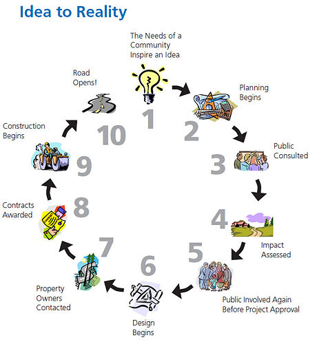
This article is a brief outline of the process involved in the path of an improvement project from the initial identification of a “need” to a completed project serving the public.
138.1 Idea to Meet Transportation Need
MoDOT considers an area’s safety concerns, growth, traffic patterns and transportation needs. When a need is identified, MoDOT meets with local government, community leaders and transportation users to discuss the project.

MoDOT proposes and evaluates several possible improvement locations and assesses possible safety improvements. The Missouri Highway and Transportation Commission reviews public comments and other information concerning the proposed improvement before further development of the improvement.
At this stage, MoDOT announces to the public what improvement is proposed to address the need. Response from the interested groups and individuals is collected and considered as development of the improvement continues.
Teams of MoDOT specialists evaluate the improvement’s impact on wetlands, wildlife, homeowners, businesses, etc. The proposed improvement is also sent to the Federal Highway Administration (FHWA) for approval. Other Federal agencies, such as the Environmental Protection Agency, Department of Interior, Corps of Engineers, Federal Emergency Management Agency and State agencies such as the Missouri Department of Natural Resources and the State Emergency Management Agency may need to grant approval for the improvement to proceed.

138.5 Public Consulted Again Before Project Approval
MoDOT holds additional public hearings to gather public comments during development of the improvement. The Commission gives final approval for the project’s location and design details.
138.6 Design
138.6.1 Value Engineering. Value Engineering (VE) helps assure the full value of every transportation tax dollar is realized. In highway construction it encourages designers to provide cost efficient designs and contractors to employ innovative construction methods to reduce costs.
138.6.2 Preliminary Plans. A preliminary plan shows preliminary geometric details and includes design criteria, proposed alignment, profile, tentative grade, tentative right of way, schematic intersection or interchange layouts, bypasses and pertinent topographic features. The preliminary plan develops and conveys basic design criteria, basic geometric details and recommendations upon which the detail plans are to be developed.
| Major Milestones for Projects |
| Conceptual Study - Date the conceptual study/3R/4R report is completed. |
| Location Study - Date location approval is granted by the Missouri Highway and Transportation Commission. |
| Value Engineering Study – VE study date to be entered for projects that have been selected for a VE study as per the District VE Work Plan. Consult with a District Value Engineering Coordinator and/or the Policy and Innovations Engineer for project selection, team composition and timing for VE study. |
| NEPA Approval Date -The date the project is given a NEPA approval from FHWA. (This approval will be a CE, FONSI or ROD). Resubmit a Request for Environmental Services if scope change occurs, e.g. additional ROW, length, or project description. Project changes warrant review of NEPA approval. |
| Preliminary Plans Approved - Date preliminary plans are completed. All changes resulting from the Design Hearing and VE Study have been incorporated. |
| Bridge Survey Submitted - Date the Bridge Survey Report is submitted to Central Office Bridge. |
| R/W Plans Approved - Date the district certifies r/w plans. |
| Project Added to STIP - Date the project has Right of Way or Construction money added to the STIP indicating MoDOT’s commitment to build this project. |
| Tract Packs Submitted - Date that information is submitted to Chief Counsel Office (CCO) enabling condemnation to begin for all parcels that have not been acquired. |
| Cultural Resources Clear - Date the State Historic Preservation Office (SHPO) has concurred that cultural resources actions taken by MoDOT are sufficient to allow the project construction to proceed. |
| 404 Permit Received - Date of permit receipt from the US Army Corps of Engineers. |
| All Environmental Issues Finalized - The date planning and negotiations have been completed for environmental aspects of the project. All permits, MOAs, mitigation plans, all agency reviews, etc. are completed or approved prior to construction for the following: Farmland Impact, Floodplain/Regulatory Floodway, FEMA/SEMA Buyout, Socioeconomic Impact, Threatened & Endangered Species, Public Land Impact, Hazardous Waste Impact, Air & Noise Impact and the Wetland Impact. Refer to EPG 127 MoDOT and the Environment. |
| R/W Clear - Date MoDOT has taken legal and physical possession of all property and district has submitted the r/w clearance certification to Central Office Right of Way Section. |
| Utilities Clear - Date the district certifies utilities are clear. This is defined as the date utility agreements have not only been executed but the adjustments are complete or at a point that no delay is expected to the road contractor. All utility adjustments have been coordinated with the road construction and all provisions have been included in the plans. Refer to EPG 643 Utility Procedures. |
| PS&E Submittal - Date the Bridge Plans, Specifications, & Estimates (PS&E) are submitted to Central Office Design. |
| Roadway PS&E Submitted - Date the Roadway Plans, Specifications, and Estimates (PS&E) are submitted to Central Office Design. |
| Processed and Ready for Letting - Verification by headquarters reviewers that all milestones are completed and the decision has been made to let the project. |
| Construction Complete - Date representing the anticipated construction completion date. |
138.6.3 Surveys. A survey physically establishes the location in the field in accord with the approved location. The survey includes the location of all man-made features in relation to the established centerline and also includes elevations on National Geodetic Survey (NGS) or United States Geodetic Survey (USGS) datum necessary to locate grades, culverts, bridges, and to compute excavation quantities.
138.6.4 Right of Way Plans. Detail plans are prepared to provide the information and details necessary to construct transportation improvements to criteria required to address the need of the improvement. The plans show all existing topographic features and the disposition of existing improvements affected by the proposed construction and indicates the right of way necessary to allow room for the improvement’s construction and maintenance, and in sufficient detail to write deeds and acquire the right of way to the dimensions shown on the plans.
138.6.5 Basic Design Criteria
Traffic. Whether the road to be improved is a major or minor roadway and its level of anticipated traffic are key elements in determining basic design controls for the improvement. Improvement projects on interstate roadways are designed for traffic projected 20 years beyond the date design of the improvement is completed. All other roadway improvements are designed for traffic projected 20 years beyond the date of construction begins.
Anticipated Posted Speed. It is desirable to select design criteria for roadway improvement projects that reflect the anticipated posted speed (previously called "design speed") of the completed improvement. Selection of these criteria must also reflect the function of the roadway, its impact on the surrounding community and the wise use of resources.
Traffic Control Devices. Signing and marking for both permanent and temporary traffic control are directly related to highway design. Effective signing and marking supplement a well-designed geometric layout by informing, warning and controlling traffic.

Hydraulics and Drainage. Drainage structures must be properly selected and sized to allow the flow of water without negatively impacting adjacent upstream and downstream property owners. Depending on the drainage area, differing methods and criteria are available to properly design drainage structure.
138.7 Construction The site of the improvement is cleared of rock and debris and heavy equipment begins grading. Crews lay pipes under the roadbed to provide drainage and build bridges over other roadways ditches and rivers.
138.8 Road Opening The roadbed is paved with asphalt or concrete. Signs are installed. The road is now complete and ready for travel.
138.9 Road Maintenance MoDOT maintains the facility to meet the needs of travelers. Should the road eventually be found to not meet travelers’ needs, a new “need” will be identified and the process to improve the facility begins again.

  |
Speaking of road maps...
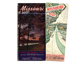
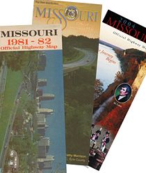
First maps: The first Missouri road map, so far as State Highway Commission files reveal, was issued in 1851 by the federal government. Primary consideration was given to steamboat travel. The first road map put out by the state of Missouri was in 1918, although a map for internal use was produced in 1917.
Most common title for MoDOT’s road map: “Missouri Official Highway Map” was used for the 1938 and 1939 editions as well as every edition except one since 1961. That one exception took place in 2013 when MoDOT produced the "Missouri Highway Map Centennial Edition" to celebrate its 100th anniversary.
Second most common title: “Official Road Map of Missouri” used for all 11 editions from 1926 to 1936.
Colored ink first used: 1926
Before our “Traveler Information Map” was on the internet: The 1940 road map stated, “The Highway Commission issues a Road Condition Map showing accurate detour information at the close of each week.”
Symbols from the past: Free bridges (1927-45 maps), Oiled graded earth all-weather (1929-31), 3-lane major highway (1954-63), Gravel/granular surfaced (1927-91), Forest (lookout) tower (1957 – 93).
Alternative map: The 1989 road map was printed with two versions. One version featured a reverse having no maps but filled with a marketing composition expounding on Missouri’s economic advantages. It was written in English, German, Japanese and Korean.
Maps and metrics: The 1918 road map featured two scales, one in miles and one in kilometers.
Stop the presses: Because of World War II, no map was printed in 1943.
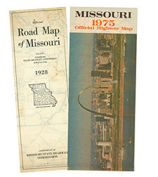
Number of times the Gateway Arch has been featured on the cover? 1 (1975)
The state capitol? 9 (including the 1976 cover featuring the previous capitol building completed in 1840 and burned in 1911 when struck by lightning)
City insets: First appearing in the 1920s, the two city insets (of St. Louis and Kansas City) grew to a maximum of 47 city insets in the 1967-69 maps.
Do you remember? Of course, over the decades roads are paved and interstates are constructed, but other changes occur, too. Before World War II, our maps displayed:
- Zebra (a town that is now Osage Beach)
- Galloway (is now part of Springfield)
- Clark National Forest (now part of Mark Twain National Forest)
- US 40 leaving St. Louis via Page Avenue, turning north on Pennsylvania west of Wellston and proceding west via St. Charles Rock Rd.
- Fairmount, Gashland, Hickman Mills, Holmes, Linkville and Nashua (all now within Kansas City)
- Shaws Garden (now Missouri Botanical Garden)
- Industrial City (now within St. Joseph)
- Former MO Rte 4 (now US 136)
- Former US 66 (the “Main Street of America” or the “Mother Road”), one of the original highways in the US Highway System, was recognized by both the hit song "(Get Your Kicks on) Route 66" and the Route 66 television series. US 66 was essentially replaced in Missouri by Interstate 44. Look for “Historic Route 66” signs along this National Scenic Byway. The corridor is also being redeveloped into US Bicycle Route 66, a part of the United States Bicycle Route System.
- Oakwood (now within Hannibal)
- Affton, a census-designated place just outside of St. Louis that was briefly incorporated as a village in the early 1930s, was shown on the map until the early 1960s.
- MO Rte 76, the most famous road in Branson where it is lined with music theaters and known as "76 Country Boulevard", before the 1950s did not even go through Branson. Its terminals were Reed Springs and Ava, a length only about 1/3 its current 180+ miles.
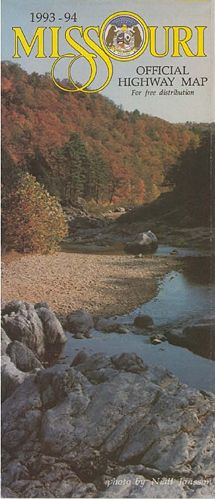
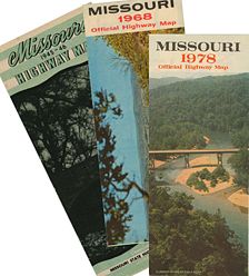
Any fads? Perhaps. Those who remember the later 1960s may not be surprised to note that the medium brown and manilla from the 1940s and white and pale green from the 1950s were replaced with especially brilliant yellow and strong oranges from 1968 to 1971. The colors were noticeably less intense by the 1993 map.

Size: The maps since 2007 are approx. 27 in. x 39.5 in., having an area about 18% larger than most previous maps. Yes, most of the new maps' print is larger than previous maps' print, too.
How many printed? In 1924, 25,000 copies were printed. (To cover printing costs, the department sold the early maps to any individual, firm or company at cost, allowing them to resell the maps for 25 cents to “make a fair profit.”) About 2.7 million 2013 maps were printed, arguably Missouri's most popular state publication. For our 2021-2022 map, 675,000 copies were made at a cost of almost 21¢ each.
