748.2 Roadway Design Criteria

748.2.1 Roadway Overtopping Design Criteria
On Major Routes, for bridges and boxes, the water level shall be no deeper than 1 foot below the lowest shoulder point during a 50- to 100-year event. For bridges and boxes on interstates use the 100-year event. For pipes, the water level shall be no deeper than 1 foot below the lowest shoulder point during a 25- to 50-year event. For pipes on interstates use the 50-year event.
On Minor Routes, for bridges and boxes, the water level shall be no deeper than 1 ft. below the lowest shoulder point during a 25- to 50-year event. For pipes, the water level shall be no deeper than 1 ft. below the lowest shoulder point during a 10- to 25-year event.
For structural replacements, the upper end of the hydraulic frequency ranges is used for high volume routes and sites requiring only minimal roadway work. The lower end of the hydraulic frequency ranges is used for low volume routes and sites requiring extensive roadway work. For new locations, consider the expected traffic volumes and length of roadway to be constructed in selecting an overtopping design frequency. When rehabilitating an existing structure it is not required that the adjacent roadway be raised to meet the roadway overtopping standards for new roads. The replacement structure should be designed such that it does not increase the frequency of roadway overtopping.
The files include a note indicating that improving the roadway overtopping frequency would have been outside the scope of the project.
748.2.2 Overtopping Flood
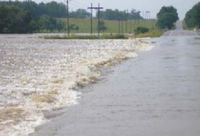
The overtopping flood is distinguished from the design criteria for roadway overtopping. The overtopping flood is the actual flood at which flow occurs over the roadway. It is used as a design scour event and as the overtopping event reported on plans.
748.2.3 High Water Marks
The districts shall keep a record of the elevation of high water marks during floods for future design purposes. High water marks should be indicated on roadway structures if possible and labeled with the year of the occurrence.